Manantiales / Reykjadalur Thermal RiverSprings / Reykjadalur Thermal River温泉・鉱泉 / Reykjadalur Thermal River
✓ Verificado el 2026-07-28
✓ Verified on 2026-07-28
✓ 確認日 2026-07-28
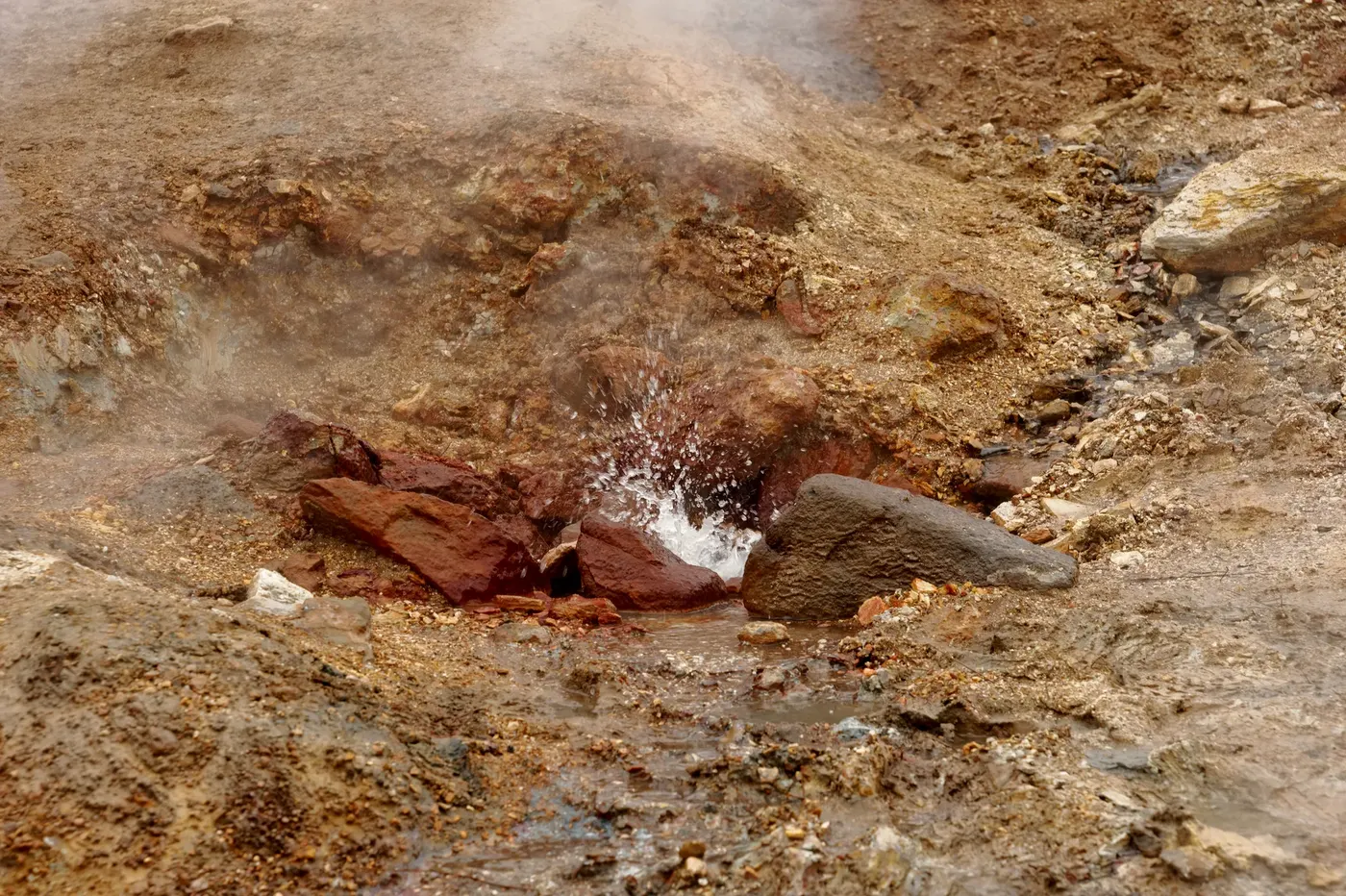
Reykjadalur es un valle geotérmico dentro del sistema volcánico de Hengill, a unos 45 km al sureste de Reykjavík y a unos 2 km de la localidad de Hveragerði. Un sendero de unos 3 km con un desnivel de 340-380 m aproximadamente asciende pasando fumarolas, pozas de barro y la cascada Djúpagilsfoss hasta llegar a un tramo de río donde el agua de manantial caliente — a unos 36-40 °C en la zona principal de baño, enfriándose a 33-35 °C río abajo — se mezcla con un arroyo frío para crear un río de baño naturalmente templado. Pasarelas de madera con mamparas de privacidad señalan la zona principal de baño en Klambragil. A lo largo del sendero, las fumarolas geotérmicas dejan depósitos minerales visibles — azufre amarillo, óxido de hierro rojo, cobre verde y sílice blanca — en el terreno.
Reykjadalur is a geothermal valley in the Hengill volcanic system, about 45 km southeast of Reykjavík and roughly 2 km from the town of Hveragerði. A roughly 3 km trail with about 340–380 m of elevation gain climbs past steam vents, mud pots, and the Djúpagilsfoss waterfall to reach a stretch of river where hot spring water — around 36–40°C in the main bathing area, cooling to 33–35°C further downstream — mixes with a cold stream to create a naturally warm bathing river. Wooden boardwalks with privacy screens mark the main bathing area at Klambragil. Along the trail, geothermal vents leave visible mineral deposits — yellow sulfur, red iron oxide, green copper, and white silica — in the ground.
レイキャダールル(Reykjadalur)は、レイキャヴィークの南東約45km、フヴェラゲルジの町から約2kmに位置する、ヘンギトル火山系内の地熱渓谷です。標高差約340〜380mの約3kmのトレイルが、噴気孔、泥火山、ドュゥパギルスフォスの滝を通り過ぎながら登り、温泉水(主要入浴エリアで約36〜40°C、下流ではさらに冷えて33〜35°C)が冷たい小川と混ざり合う自然に温かい入浴用の川に至ります。クランブラギルの主要入浴エリアには、目隠し付きの木製遊歩道が設けられています。トレイル沿いでは、地熱噴気孔の周りに黄色い硫黄、赤い酸化鉄、緑の銅、白いシリカなどの鉱物の堆積物が目に見える形で残されています。
Técnicas
Techniques
技法
Bathing
Otros manantiales en Iceland