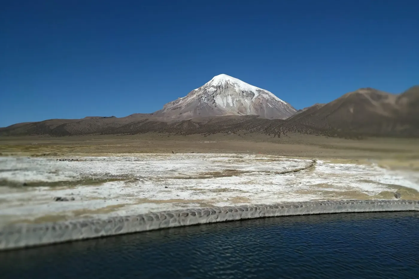
Photo by LichB, via Wikimedia Commons (CC BY-SA 4.0)
🇧🇴 Bolivia · Oruro Department
Photo by LichB, via Wikimedia Commons (CC BY-SA 4.0)
🇧🇴 Bolivia · Oruro Department
♨ Temperature
40°C
⛰ Altitude
4200 m
⚗ pH
7
💧 TDS
950 mg/L
🌊 Flow rate
8 L/s
📅 Established
Pre-colonial
✓ Verified on 2026-07-22
The geothermal hot springs of Sajama sit in the volcanic altiplano of western Bolivia at an altitude of over 4,200 metres, making them among the highest-elevation thermal bathing sites on Earth. The springs are fed by geothermal activity related to Nevado Sajama — Bolivia's highest mountain at 6,542 metres — and emerge as warm pools in a landscape of stark volcanic beauty: open altiplano grassland (puna), wandering vicuña, flamingo-frequented lagoons, and the snow cone of the volcano dominating the horizon. The Aymara communities of the area have traditionally used the springs for bathing and, in some seasonal contexts, in ceremonial practice.
| Sulphur | 28 mg/L |
| Sodium | 145 mg/L |
| Bicarbonate | 380 mg/L |
| Fluoride | 2.8 mg/L |
The hot springs within Sajama National Park have been part of the Aymara cultural landscape for centuries, connected to the sacred status of Nevado Sajama — the highest point of Bolivia and a mountain of deep cosmological significance in Andean tradition.
Bathing at 4,200 metres under the watch of a 6,542-metre snow volcano is an experience that distils the raw intensity of Bolivia's altiplano environment. The Sajama springs offer thermal comfort in one of the most extreme terrestrial landscapes accessible to travellers.
Sajama National Park is Bolivia's oldest protected area, established in 1945. The hot springs are managed as a natural attraction within the park, with community-led tourism infrastructure designed to benefit the resident Aymara villages.
Websitewww.bolivia.travel
AddressSajama National Park, Oruro, Bolivia